 SurveyorSim
student guide · the exercises
What each exercise is asking you to do
Seven kinds of assignment ship with SurveyorSim. Your instructor sets the numbers — how many points, how tight the tolerance, what the site looks like — so this page does not quote any of those. What it gives you is the shape of each exercise and the one thing students most often get wrong in it.
Before any of them
true of every exercise- The task panel is the assignment. It carries the objective, the tolerance you are being held to, and a numbered What to do list. Those numbers are your instructor's, not this page's.
- The names are your instructor's too. Marks called BM-A or CTL-1 are what the sim invents when nobody has authored a site. On a site your instructor drew, the marks carry whatever names they typed.
- Kit can be withheld, and nothing on screen says so. If a button you expected — the shot log, the calculator, the data collector — is not there, your instructor took it out of your kit on purpose for this assignment. It is not a broken page, and the sim will not name what is gone. Work with the kit you have.
- On a crew, only the chief hands in. Whatever you type on your own screen stays on your own screen.
- Submit is final, and you are asked to confirm it. If a banner ever says nothing is being saved, stop and tell your instructor — that one is not recoverable.
Differential leveling loop
the one graded from your bookRun a level loop over the benchmarks and close within the order tolerance.
Set the level, read a backsight, walk it forward turning point by turning point, and close. The instrument is an automatic level: its setup is shorter than the total station's — legs and bubble, and the compensator does the rest. No plummet, no instrument height to measure.
- Your allowance is not a fixed number. It grows with the length of the loop you actually walk, and it stops shrinking at one graduation of the rod.
- A loop closes on the benchmark it started from. Some runs instead finish on a different benchmark — that is a link, not a loop. Either way your closing tag goes on the benchmark you finished at, and tagging the one you started from is graded against the wrong published elevation.
- Your page also needs a title line, and the graph page a sketch. Nothing prompts you.
Closed traverse
occupation, not just anglesOccupy the control points, turn the angles, close the loop, and fix each point to the required accuracy.
Set up over each control point in turn, backsight the previous one, turn the angle to the next, and measure the distance. Shoot both faces and mean them — that is what cancels the instrument's collimation and index error. On a real instrument it is not your only defence: those corrections are determined on site and stored, and repeating the angle on several circle positions beats down what face-meaning leaves behind.
Three things are graded, equally:
- Every control point occupied. The instrument has to stand over each one. Shooting a point from somewhere else is not occupying it.
- The loop closed. Your closing sight back on the start, against the coordinate on its sign, over the length of the loop — the same misclosure you compute yourself. The loop is the chain your coordinates were carried round, so every control point has to be in it.
- Every point in position. Each control point against where it truly is.
Your standard is on the task panel, and both the closure and the positions are held to it. The two can disagree, and that is a lesson, not an error: a loop can close well and still sit turned or stretched as a whole. The closure is the check you can make standing on the site, and it is the one your instructor will ask about.
Chaining / taping
a foot tape, alwaysChain between the set marks and report each measured horizontal distance.
Take the tape from your kit and measure between the marks, then report each distance in the task panel. On broken ground you will need to break the chain — level the tape in stages rather than dragging it down a slope.
Feedback on each leg tells you the direction only: within tolerance, too long, too short, or not reported. It never tells you by how much, on purpose — that would hand you the answer.
Monument recovery
the shovel is graded tooTurn the record angles and distances from control, then dig to recover the monuments.
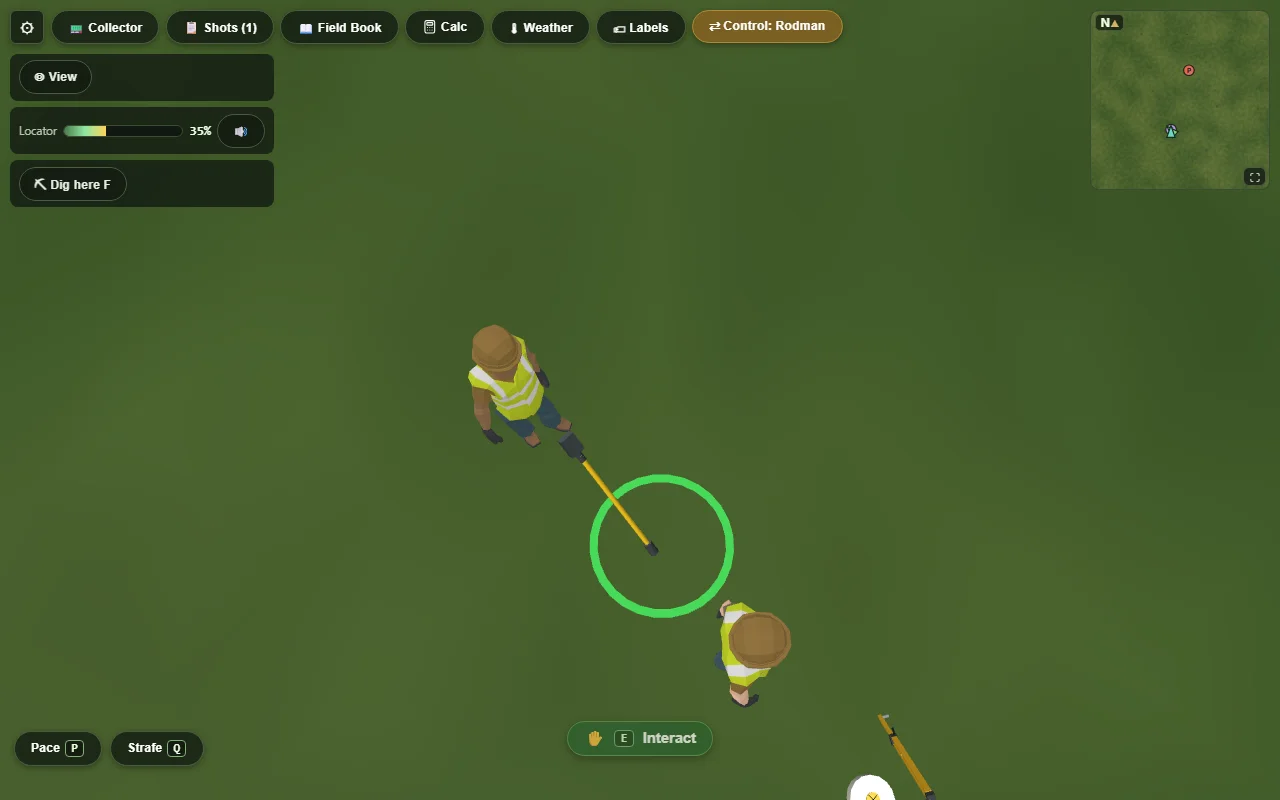
You are given record measurements from known control. Turn them, walk out to where the monument should be, and dig. The monument is really under the ground — finding it is the exercise.
- Your digs are counted, and the count is a graded line. Digging a trench across the site is not a strategy.
- Backfilling does not hide a hole. The record of where you dug is kept either way.
Stakeout
judged on your worst stakeStake the design points within radial tolerance of their true positions.
The design coordinates are on the task panel, in a section headed Design points. Set up, compute or read off the direction and distance to each, and put a stake in the ground.
Topographic survey
coverage is the exerciseMap the ground inside the marked square: shoot enough well-placed points that a contour map could be drawn from them.
Radiate from published control and shoot the ground — breaks in slope, the tops and bottoms of banks, and enough of the flat between them that a contour could be drawn through your points.
- Coverage is checked cell by cell. A cluster of shots in one corner and a bare patch elsewhere fails, however many shots you took.
- Only shots inside the square count. The corner stakes are the boundary of the job, not decoration.
Open world
your instructor sets the taskAn open-ended session on a site your instructor has built. The task is not in the sim — it is on their handout, or on notes placed around the site itself. The panel still gives you steps, and they are about finding the task rather than doing it.
- Walk into a note to read it. Notes are placed on the ground and open when you reach them.
- The notes may be in order. On some sites note 2 will not open until you have walked into note 1. If a note seems dead, you have probably skipped one.
- Nobody grades this automatically. Your instructor reads the record and assesses it themselves — so what you leave behind in the field book and the collector is the whole submission.